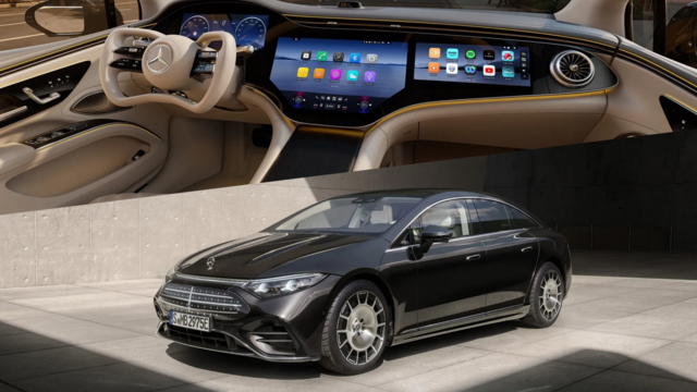

For those of you that think COMAND is outdated...

Thread Starter
MBWorld Fanatic!
Joined: Nov 2004
Posts: 1,691
Likes: 143
W221 S600, W220 S55 AMG Kompressor, W124 300E, W140 S320, W210 E3204M W164 ML320 Bluetec
For those of you that think COMAND is outdated...


MBWorld Fanatic!


Joined: Jan 2005
Posts: 2,848
Likes: 15
From: Orange County
2005 C Wagon (No snickering please!)
Looks like we are back in 2005. Why would I want a nav system with a monthly fee? Are they building new highways so often I need the internet to keep me updated? All these features live in my laptop, and it has a 17 in screen.
Thread Starter
MBWorld Fanatic!
Joined: Nov 2004
Posts: 1,691
Likes: 143
W221 S600, W220 S55 AMG Kompressor, W124 300E, W140 S320, W210 E3204M W164 ML320 Bluetec
People pay monthly fees for SDARS and Tele-Aid all the time. I am not saying I am a big fan of monthly fees, but this is pretty nice technology... although it would be useless in fringe areas unless they have an HDD or DVD as a backup storage device. Work in progress I am sure, but still impressive telematics.

MBWorld Fanatic!
Joined: Dec 2004
Posts: 3,063
Likes: 27
From: Tampa, FL
2005 S500 4-Matic, 1978 450SL
It's a great technology, and offers far more than anything I have seen for car systems, whether from Europe or Japan.
In my own area, which is not a new development (mid-'80's), there have been three major new, or altered, Interstate exchanges, and a new bridge is going up soon that will directly affect my neighborhood - over the course of two years. Just 5 and 10 miles north, there are huge alterations taking place in major roads and Interstate interchanges. And, all around us, old 2-lane roads built in the '80's are being widened to four, six, and in one case, eight lanes to alter traffic flow. It's the kind of stuff on which I'd like to keep current more than annually, using an already year-old database in the latest disc.
Thanks for the video, Polar Bear.
In my own area, which is not a new development (mid-'80's), there have been three major new, or altered, Interstate exchanges, and a new bridge is going up soon that will directly affect my neighborhood - over the course of two years. Just 5 and 10 miles north, there are huge alterations taking place in major roads and Interstate interchanges. And, all around us, old 2-lane roads built in the '80's are being widened to four, six, and in one case, eight lanes to alter traffic flow. It's the kind of stuff on which I'd like to keep current more than annually, using an already year-old database in the latest disc.
Thanks for the video, Polar Bear.
Last edited by Skylaw; Nov 22, 2008 at 08:58 AM.


MBWorld Fanatic!

Joined: Dec 2006
Posts: 6,499
Likes: 335
From: Europe
223.168 & 213.012 & 906.633 & 214.005
Browser based applications would bring a lot of flexibility and on a Windows CE based device, should not be difficult to implement and run.
Google maps would be a nice add-on but a traditional kind of stored maps option would be a must for the next 20 years if not longer. Low cost and high BW wireless data at deserts would not appear very soon.
But an extension of features that already exist on mobile phones where a combination of stored maps and network server support is used would easily make the car application realistic.
Google maps would be a nice add-on but a traditional kind of stored maps option would be a must for the next 20 years if not longer. Low cost and high BW wireless data at deserts would not appear very soon.
But an extension of features that already exist on mobile phones where a combination of stored maps and network server support is used would easily make the car application realistic.