When you click on links to various merchants on this site and make a purchase, this can result in this site earning a commission. Affiliate programs and affiliations include, but are not limited to, the eBay Partner Network.
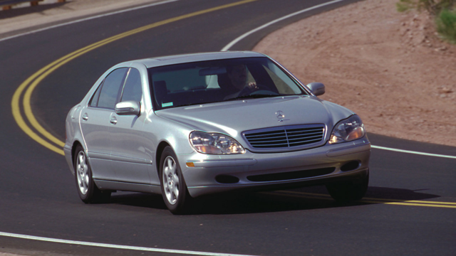
Last spring, after a 6-month layoff to recuperate from major foot and ankle surgery, I fired up the Mercedes-Benz SL550 and tentatively embarked on another tour. I stayed close to home and split the driving over 2 days, in case I ran out of steam. The result was a series of interesting places, all within shouting distance of my home in Catonsville, Maryland. Moreover, my foot held up well, and the SL was thrilled to be back on the road�I could tell!
What, Exactly, Did I Interrupt??
The Chesapeake Bay was the object of my exploration. Since the Bay is about 200 miles long, with 11,684 miles of shoreline, I limited myself to the western shore between Edgemere and Thomas Point (day 1) and the eastern shore between Stevensville and Tilghman Island (day 2). I�ll save the rest for another time.
My first stop was Fort Armistead on the Patapsco River, 7 miles downstream from Baltimore�s Inner Harbor and 7 miles upstream from the Chesapeake Bay. The fort was built in the late 1800s to help protect the approach to the harbor during the Spanish-American War. In 2023, however, the abandoned fort serves as a secluded meeting place for any number of illicit goings-on. I had to step carefully to avoid used needles, used condoms, and other used items I couldn�t even identify. (Think I�m kidding? Check out NPR�s �What�s the Story with Fort Armistead?�.)
With the help of trekking poles, I managed to climb up into the woods and find the fort�s old battery emplacements. Underneath all the graffiti, this was the upper level of Battery McFarland, one of four such batteries at the fort.
The concentric stone circles in this photo were once part of a massive, 8-inch �disappearing gun,� which could fire a 260-pound exploding shell as far as 8 miles. The gun was mounted in such a way that it could be lowered out of sight behind the battery walls. Fort Armistead had 3 of these guns, in addition to a 12-inch version with a range of 10� miles and 4 other smaller-calibre guns. (Photo of similar M1895 gun courtesy of the Coast Defense Study Group.)
Although Fort Armistead is an official Baltimore City Park, it�s obviously not a great place to visit except for its nice fishing pier. My primary reason for coming here was to get a photo of Fort Carroll, in the middle of the Patapsco River. When I arrived, I parked near a wooded area and wandered in, looking for a vantage point. Almost immediately, an oldish white guy parked nearby and walked in after me. I soon realized that there wasn�t a good vantage point and turned around to leave. I said, �Pretty day, eh?� to the other fellow, who just looked at me peculiarly. As I left the trees, a middle-aged African American man was just parking nearby and heading for the woods, passing me by and making a beeline for the other guy. That fellow looked a bit uneasy, jumped in his car and drove off.
No one had been anywhere near this area until I arrived, and I couldn�t help wondering what was going on? Had I interrupted a drug deal? A sex arrangement? A multi-cultural prayer meeting in the woods? Well, I didn�t stick around to find out! I did, however, drive over to the fishing pier, where I found a spot to take this hazy photo of Fort Carroll, sitting in the river almost a mile away.
Prior to Fort Carroll�s construction, the only fort defending Baltimore was Fort McHenry�well known for its role during the War of 1812, when it withstood the British Navy�s bombardment and helped protect Baltimore from capture. That episode also prompted Frances Scott Key to write the words to �The Star-Spangled Banner,� which later became the national anthem. (Painting of �Rockets Red Glare� by Abraham Hunter.)
To add to Baltimore�s defenses, in 1847 one Robert E. Lee designed a hexagonal fort and supervised its construction on a man-made island in the Patapsco. Fort Carroll was intended to have 225 cannons arrayed on 3 levels around the walls, but it was never fully armed. In the late 1800s, the outdated cannons were replaced with guns similar to those at Fort Armistead. (The cannons shown below are replicas, built for an ill-fated effort to turn the abandoned fort into a casino and hotel complex. Photos courtesy of the Baltimore Sun.)
Fort Carroll was abandoned in 1920, as was Fort Armistead. Today, Fort Carroll�s 3� acres are home to thousands of seagulls, egrets, cormorants, and herons. Its old wooden lighthouse somehow manages to remain standing, even though it hasn�t been used since 1945.
Hey, Let�s See if this Cannon Still Works!
While the British were bombarding Fort McHenry on September 12, 1814, they were also landing 4,700 soldiers at the North Point Peninsula under the command of Major General Robert Ross. Their goal was to capture and burn the port of Baltimore, just as they had done a month earlier to the city of Washington. The British were thwarted, however: first when Gen. Ross was killed by a sharpshooter, then by fierce resistance from the Maryland Militia at North Point, and finally by the sight of 22,000 troops and 100 cannons defending the eastern portion of Baltimore at Hampstead Hill. The British retreated, and Baltimore was saved. It was the �beginning of the end� for the British in the War of 1812. (�Battle of North Point,� a National Guard Heritage Painting by Don Troiani, courtesy of the National Guard Bureau.)
The American forces had been warned of the British advance by a local resident named Thomas Todd. From the cupola of his house, he had spotted their ships in the Chesapeake Bay. In retaliation, the British burned his house to the ground as they retreated, but Todd built a new house on the old foundations in 1816. His ancestors had owned this property since 1664, and it remained in the Todd family through the early 1970s. The house is now owned by the State of Maryland.
In 1896, North Point Peninsula became home to Fort Howard, another in the series of forts built to protect Baltimore during the Spanish-American War. Its four batteries used 12-inch guns and mortars, together with a number of smaller-calibre guns. In 1908, the fort�s Coast Artillery Corps gunners hit 9 out of 10 moving targets at a range of 5,000 yards (2.8 miles). Their one miss resulted from a defective shell�but they still set a world record for accuracy.
Unlike Fort Armistead, Fort Howard is now a �proper� Baltimore County park, and I was pleased to see a number of visitors enjoying the nice day here. This was Battery Nicholson. In its prime, it would have looked much like the installation in Brooklyn, NY, shown below.
The back of Battery Stricker features this long colonnade.
Inside the batteries were shell and powder rooms. (And no, the �powder room� was not for touching up one�s makeup.) These days, the entrances are mostly barred but the rooms still manage to contain an assortment of cryptic symbols, graffiti, and the occasional framed painting.
For many years, Fort Howard has been hosting a Halloween �Haunted Dungeons� tour.
Targeting enemy ships required use of a high-power telescope and a team of mathematicians to calculate the trajectory settings for the guns. But what happened if enemy ships arrived at night? For that contingency, this building housed generators for powering the fort�s searchlights.
Battery Harris was one of the smaller emplacements. But on the day I visited, it featured this authentic, late-1800s, severed manikin leg�
The big guns at Fort Howard are long gone, having been removed after World War II. But the park has a pair of much smaller 120mm M1906 field pieces on display. �Smaller� is a relative term; they each weigh about 4 tons, and their barrels are more than 11 feet long. They were placed at Fort Howard in 1975. While renovating the artillery pieces in 2015, Army National Guard technicians discovered that both of the guns were in complete working order. Anyone with a spare 45-pound shell could have fired it at will! (In a lamentable fit of public responsibility, the workers removed the firing pins and cemented the barrels shut.)
Last edited by Rick F.; Jul 26, 2023 at 06:16 PM.
Reason: Replace "550SL" with the correct "SL550." Sheesh!
The SL550 was really in its element, cornering as if on rails and leaping from one corner to the next in a blur of roadside scenery. It's a good thing it has large brakes, or we would have been doubling or tripling every speed limit in the state… Before moving on to the last of the Baltimore harbor forts, I detoured over to Miller’s Island for a look at the Lower Craighill Rear Light. It’s located a quarter mile off Ramona Beach, which itself is near Cuckold Point (and no, I have no idea how this area got its name!) It seemed like a nice neighborhood, although it might be the first to go underwater as the Chesapeake Bay continues to rise…
Just offshore is Pleasure Island. Farther in the distance is the much larger Hart-Miller Island, which is a state park accessible only by boat. Think I was kidding about the rising water level? Both islands used to be an integral part of the Miller’s Island peninsula.
The 1875 lighthouse itself is an impressive structure. At 105 feet high, it’s the tallest lighthouse in Maryland. The central column is made of wood and contains a rickety staircase to the light. There used to be a house for the lightkeeper on the lower level, but it became unnecessary when the light was automated in 1923. The Craighill Light is still in operation. (Vintage photo of the Craighill Light courtesy of the U.S. Coast Guard.)
Crossing back over the Francis Scott Key Bridge, I drove out to Fort Smallwood—the last of the several forts surrounding the entrance to Baltimore Harbor. Since 1926, Fort Smallwood has been an immensely popular park, with beaches, fishing, playgrounds, and other attractions. Battery Hartshorne was the fort’s sole gun site during 1898-1920, and the park staff have kept it looking nice and tidy.
I admired these tall grasses as I moved on toward my next destination.
How often do you see a bakery that is advertised by a giant pink pig wearing an apron and chef’s hat?
For that matter, how often to you see a Ferrari 360 Spider tooling top down along a crowded highway?
A few miles later, I was off the highway and onto this dirt road, in search of what was left of the original settlement of Cape St. Claire, MD.
I found Goshen Farm at the end of the lane, situated on top of a hill. The farmhouse dates to the late 1780s; over the years, 2 other houses have been moved here and incorporated into the structure.
This is the front of the original farmhouse. Its wide porch was enclosed sometime along the way. (Historical photo of Goshen Farmhouse courtesy of the Goshen Farm Preservation Society.)
Roy Benner is a member of the Board of Directors for the Preservation Society, and he has worked tirelessly to preserve and repair Goshen Farm. He generously took time out from restoring this servant’s quarters to show me around the farm. The term “servants’ quarters” is usually a euphemism for a building that housed enslaved African Americans. But in this instance, the structure was home to a voluntary, paid servant named Benjamin Hill. Between 9 and 12 enslaved African Americans helped build and operate Goshen Farm, but their living quarters are long gone, as are most of the other farm buildings.
There are many historical features inside the farmhouse, such as this downstairs fireplace. Before the Preservation Society stepped in, the house had been deteriorating and vandalized for many years. Roy and other members have since made substantial progress in rehabilitating the old place.
As a result of the various additions and modifications, it would be easy to become lost in the house. The Society’s first priority has been to stabilize the building and prevent further damage. A new roof and windows have gone a long way in accomplishing this goal.
This tiny staircase leads to the third story of the house. I didn’t dare try to ascend it, as my size-12 feet were far too large for the narrow steps!
Fort Nonsense?
After thanking Ray for his very informative tour, I meandered in the direction of Annapolis, the capital of Maryland and home to the U.S. Naval Academy. Naturally I was in search of yet another old fort—in this instance, Fort Nonsense. I stopped along the way for a picture of St. Margaret’s Church, which has one of the oldest continuously operating congregations in the country. The church was formed in 1692, and their current building is the fifth one to serve the community, having been built in 1892.
I knew I was near Annapolis when I saw these huge propellers. They’re from a German destroyer that was captured during World War II, and they mark a memorial to the Annapolis Laboratory of the Naval Surface Warfare Center. The lab operated here for nearly 100 years. Among its many achievements were breakthrough advancements in the silent operation of submarines, superconductivity, metallurgy, and propulsion systems. The Annapolis Laboratory closed in 1999 as a result of legislation to downsize military bases.
While driving around on the east side of the Severn River, across from the Naval Academy, I happened across this dry-docked Navy ship. The “YP” in its number designates “Yard Patrol”—i.e., one of the ships that patrols in the vicinity of the Academy. It was in for repairs at the Naval Academy’s Waterfront Readiness Department, which trains midshipmen in maintenance and repair of Navy vessels. The facility also trains them in marksmanship. The amazingly knowledgeable Internet notes that this particular ship is 116 feet long, 28 feet wide, draws 7.9 feet, is powered by twin 600-horsepower diesel engines, and was placed in service at the Naval Academy in July 2014. It is crewed by 4 officers and 6 midshipmen. (Who knew?)
Atop a hill in the middle of the old Annapolis Laboratory campus, I finally located Fort Nonsense. Around the time of the American Revolution, several forts were built to defend Annapolis Harbor. Most included at least rudimentary protective walls and buildings. The first of these, Fort Severn, eventually housed the new Naval Academy in 1845. Others were added over time, but none of them survives today—except for the most rudimentary fort of them all, Fort Nonsense.
Fort Nonsense is roughly circular, with 2 earthen banks and a diameter of about 100 feet. The embankments are still there and are in pretty good condition. Surprisingly, no one knows how Fort Nonsense got its name. My guess? Field artillery in the early 1800s had a maximum range of about 1,000 to 1,500 yards. Fired from Fort Nonsense, a 6-pound shot would barely reach the mouth of the Severn River, let alone the Chesapeake Bay, thus limiting the fort’s ability to defend against enemy ships approaching Annapolis.
A Rich Widow, a Painter, and a Summer Home for Dad
By now it was late afternoon, on a Friday, and everyone in Annapolis was leaving for the weekend. Traffic was entirely snarled as I motored through the town, but it was a beautiful day, and I didn’t mind.
Southwest of town, I found the Primrose Hill mansion sitting incongruously in the midst of a modern housing development. The house was built in about 1760 for Mary Young Woodward, a wealthy young widow with 4 daughters. In 1763, she married an American painter named John Hesselius, and they made their home at Primrose Hill.
John Hesselius was the first native-born artist in the United States. As a well-regarded portraitist, he painted numerous well-to-do families in the Mid-Atlantic area. He was also the first teacher of artist Charles Wilson Peale. As illustrated by Hesselius’ paintings of Eleanor Calvert and Henry Fitzhugh below, many of his painted subjects tended to have similar facial features.
Much of Mary Hesselius’ wealth can be attributed to the 20 to 30 enslaved African Americans who worked on the Primrose Hill plantation and her other properties. Slavery was common in Maryland, as evidenced by the stories of Harriett Tubman, Frederick Douglass, and other enslaved residents. When slavery was abolished in 1864 by a new State constitution, many African Americans began to form new communities. In 1893, well-to-do African Americans in Washington, DC and Baltimore joined together to create a new resort community called Highland Beach, located about 3� miles south of Annapolis. In 1922, Highland Beach became the first incorporated African-American municipality in Maryland.
The idea for Highland Beach came about when Charles Douglass, the youngest son of Frederick Douglass and a veteran of the Civil War, was visiting the area with his wife Laurel. They attempted to have lunch at a restaurant in nearby Bay Ridge but were refused service because of their race. Charles “got mad” and “got even,” buying 40 acres of land just southwest of Bay Ridge and selling lots to other interested African Americans. Highland Beach soon became a favorite place to visit and/or live for such notable individuals as W.E.B. Dubois, Harriet Tubman, Paul Robeson, and many others. Alex Haley, Bill Cosby, and Arthur Ashe all owned houses here. The town remains a unique and historic enclave, with most of its population now living here year-round. (Photo of 22 happy Highland Beachgoers in 1930 courtesy of the National Museum of American History. I believe their imposing vehicle is a 1930 Packard Roadster, complete with storage trunk, side-mount spares, and a fold-down windshield.)
The house pictured earlier is named Twin Oaks. Charles Douglass built it as a retirement home for his father, but Frederick Douglass passed away before the house was completed. It now serves as the Frederick Douglass Museum & Cultural Center, with tours available by appointment.
After 160 miles and 8 hours of touring, it was time to head home—and to finish planning the second half of the tour, along the Chesapeake Bay’s eastern shore. My ankle was doing okay, and it was a real pleasure to be at the wheel of the SL550 again after such a long layoff. The car ran perfectly and was equally at ease whether ambling around in search of the lost and forgotten, or roaring hell-bent toward the next objective. Stay tuned for Part 2…
Rick F.
PS: Unless otherwise noted, historical photos are courtesy of the Library of Congress or the National Register of Historic Places.
Wow!! Hell of a thread you have here. Great pictures too. use some type of filter or something on the pics??
hyperion667,
Thanks much, I'm glad you enjoyed the report!
As for the photos, they use high dynamic range (HDR) technology. At each scene, you take 3 photos, at �2 stops, 0, and + 2 stops. Then you put the 3 exposures together in a way that captures the full range from light to dark in far more detail than you can get from a single picture. I tend to get a little carried away with saturation and contrast, but I do like a dramatic photo. If you're not already familiar with HDR photography, you can learn more about it at https://www.hdrsoft.com, the makers of the Photomatix Pro software that I use.
Ha ha, no, I wasn't a history teacher. In high school and college, I never really cared much about history. However, now that I'm old enough to be part of history, I can't get enough of it! My education and career were in mathematics and actuarial science, respectively. Maybe in my next iteration I'll take up painting, or architecture�
Please do share your photo filter with the group. I love the subtle effect.
fun33,
Per my response above, I use HDR photography to better capture the true range of light, from brightest to darkest. Here's an example. The following 3 exposures at 0, �2 stops, and +2 stops�
�are combined into the following result, which benefits from more detail and better exposure in light, medium, and dark sections of the scene. I also removed the ugly power lines for good measure:
iPhones have a mild HDR setting available. Most digital cameras these days can be set to take the �2, 0, +2 exposures automatically. And the results can be combined in Photomatix Pro, PhotoShop, or other editing software.
As for the photos, they use high dynamic range (HDR) technology. At each scene, you take 3 photos, at �2 stops, 0, and + 2 stops. Then you put the 3 exposures together in a way that captures the full range from light to dark in far more detail than you can get from a single picture. I tend to get a little carried away with saturation and contrast, but I do like a dramatic photo. If you're not already familiar with HDR photography, you can learn more about it at https://www.hdrsoft.com, the makers of the Photomatix Pro software that I use.
Rick
Yes, a type of layering. They're all great, I never want to spend that much time (anymore) on pics I take.
Rick, as always a very interesting, fascinating and educational voyage in the SL. Well done again, I have enjoyed your 'coffee table travels' for years now, thanks for posting! Two asides; when we lived in Savannah, Fort Pulaski was nearby at the headwaters of the Savannah River. It was part of the coastal fort defenses built in the early 1800's. As you noted with Fort Carroll, one recent graduate of West Point, Lt. Robert E. Lee was responsible for designing and constructing the drainage control for Fort Pulaski, which still looks today as it did when it was built. Second, I have been doing some scouting about myself, albeit in our E450 wagon, and in East Tennessee, I discovered a historic figure whom I had never known about. If you have interest, look up Thomas Amis. During the Revolutionary War he was a thorn in the side of the British, and had to flee the Carolinas moving into East Tennessee about 1780. Lots of history moved around this man, most intriguing fellow. So this fall, I am headed up to Easton, MD, where a friend has restored an 1800s home near downtown. Cannot wait to revisit that area, not only lovely in view, but rather pleasing to the pallet as well. Thanks again, get well and keep driving! Oh, and also just got back from historic races at Road America. So much fun. Photo of the Ferrari 410S which Carroll Shelby campaigned in the 1950's; still makes some gorgeous sounds.
Yes, a type of layering. They're all great, I never want to spend that much time (anymore) on pics I take.
hyperion667,
Yep, I know the feeling! But that creative control is just so addictive�
FWIW, there are a number of cameras out there now that will automatically shoot the 3 exposures (or 5 or even 7) and then combine them using their internal software to produce a single, final image.
Rick, as always a very interesting, fascinating and educational voyage in the SL. Well done again, I have enjoyed your 'coffee table travels' for years now, thanks for posting!
Two asides; when we lived in Savannah, Fort Pulaski was nearby at the headwaters of the Savannah River. It was part of the coastal fort defenses built in the early 1800's. As you noted with Fort Carroll, one recent graduate of West Point, Lt. Robert E. Lee was responsible for designing and constructing the drainage control for Fort Pulaski, which still looks today as it did when it was built.
Second, I have been doing some scouting about myself, albeit in our E450 wagon, and in East Tennessee, I discovered a historic figure whom I had never known about. If you have interest, look up Thomas Amis. During the Revolutionary War he was a thorn in the side of the British, and had to flee the Carolinas moving into East Tennessee about 1780. Lots of history moved around this man, most intriguing fellow. So this fall, I am headed up to Easton, MD, where a friend has restored an 1800s home near downtown. Cannot wait to revisit that area, not only lovely in view, but rather pleasing to the pallet as well.
Thanks again, get well and keep driving! Oh, and also just got back from historic races at Road America. So much fun. Photo of the Ferrari 410S which Carroll Shelby campaigned in the 1950's; still makes some gorgeous sounds.
TennesseeZ4,
Always great to hear from you, and thanks for your comments!
Regarding Robert E. Lee, it's interesting that his engineering work in Savannah occurred shortly after he graduated from West Point; then, late in his engineering role, he worked at Fort Carroll�and right afterwards became the Superintendent of West Point.
I hadn't run across Thomas Amis before. He does, indeed, sound like quite an interesting and accomplished person. I've added his house to the list of places I'd like to see.
Finally, thanks for the photo of Carroll Shelby's Ferrari�beautiful. What a treat to see that car in person. In addition to Shelby, it was driven by a long list of famous racers, including Juan Manuel Fangio, Richie Ginther, Phil Hill, Masten Gregory, Jo Bonnier, and Eugenio Castellotti. It sold at auction last year for $22 million, which was considered a bargain for such a beautiful and historic Ferrari.
Have fun in Easton. Let me know if you'd like to get together for lunch while you're there. I'd be glad to drive down and get some more Chesapeake Bay seafood!
Yep, I know the feeling! But that creative control is just so addictive�
FWIW, there are a number of cameras out there now that will automatically shoot the 3 exposures (or 5 or even 7) and then combine them using their internal software to produce a single, final image.
Rick
That's awesome. I've retired a few 35mm camera's from the 80's, and have been using a Canon Eos 60D for about 15 years which is a great camera. I have several lenses that are fun too (Ef-S).
Ha ha, no, I wasn't a history teacher. In high school and college, I never really cared much about history. However, now that I'm old enough to be part of history, I can't get enough of it! My education and career were in mathematics and actuarial science, respectively. Maybe in my next iteration I'll take up painting, or architecture�
Rick
Did you pass all the Exams? Almost embarked on that career path but chose Engineering instead after 1977 HS Summer program at Carnegie Mellon University for STEM and Actuarial Science. My mom worked for Metropolitan in Manhattan. Spent my summers in Tidewater area of Virginia catching Crabs. Still have an Aunt who lives on Chincoteague Island year round now.
That's awesome. I've retired a few 35mm camera's from the 80's, and have been using a Canon Eos 60D for about 15 years which is a great camera. I have several lenses that are fun too (Ef-S).
hyperion667,
I was a little slow in converting from film to digital. I had a Nikon FE that was a great camera, and I well remember sending rolls of Kodachrome off to Kodak for processing. But I don't miss changing rolls of film in the pouring rain, or discovering that I only have 2 shots left when I finally reach a scenic mountaintop in the Northern Mariana Islands�
I used a series of Canon SX "superzoom" camera for a long time, and I love Canon's color palette. But when it was time for greater resolution, I went with a Sony a6400. Someday, I'll probably return to Canon.
Did you pass all the Exams? Almost embarked on that career path but chose Engineering instead after 1977 HS Summer program at Carnegie Mellon University for STEM and Actuarial Science. My mom worked for Metropolitan in Manhattan. Spent my summers in Tidewater area of Virginia catching Crabs. Still have an Aunt who lives on Chincoteague Island year round now.
Great Story Telling!
Drone_S213,
Thanks!
As for the actuarial exams, I did pass them all and became a Fellow of the Society of Actuaries as a result. It took me 8 years�which is about average. Your summers in Virginia sound idyllic. I've only been crabbing a few times, but there's nothing like freshly caught steamed crabs!
Mercedes SLR McLaren 722 S Is Extremely Rare Example Modified by McLaren
Slideshow: A one-of-one U.S.-spec Mercedes-Benz SLR McLaren Roadster became even rarer after a factory-backed transformation at McLaren's headquarters.


")


 Thanks for pointing this out to me�it's clear I've been away from touring for too long!


