When you click on links to various merchants on this site and make a purchase, this can result in this site earning a commission. Affiliate programs and affiliations include, but are not limited to, the eBay Partner Network.
An SL550 in Search of Fall Colors (Part I and Part II)
Having purchased a new 2020 Mercedes-Benz SL550 in September, it seemed fitting to use it to seek out Fall Colors in Pennsylvania and Maryland. For new readers, I�ve been riding and driving to find places of historical, scenic, or other interest for the last 15 years�first on BMW motorcycles, then in BMW cars, an Aston Martin, and now, most recently, in the SL550. You can find all of my previous trip reports at http://rsftripreporter.net. If you like this report, you�ll like the others. If not, they might still serve as a useful cure for insomnia�
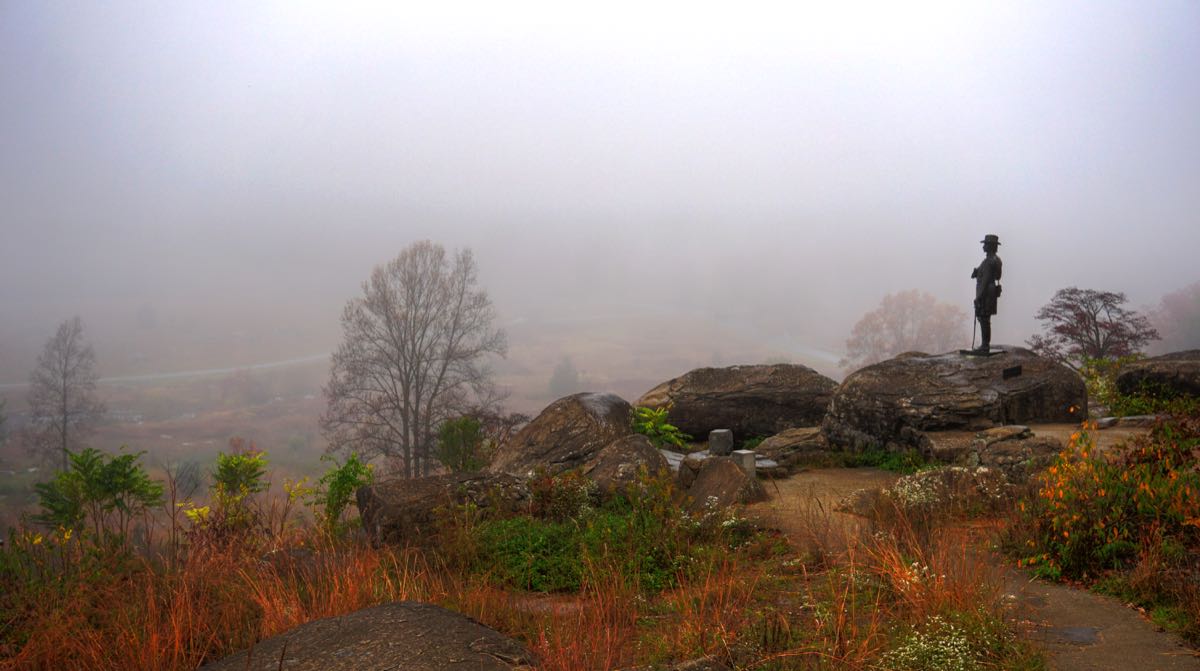
My first stop for Fall Colors was at the Gettysburg, PA battlefield. There, in the early morning, I found impenetrable mist obscuring any sign of the foliage. This photo was taken from Little Round Top, which the Union Army held to great effect throughout the 3-day battle in July 1863.
The lifelike statue at right depicts Union Brigadier General Gouverneur Kemble Warren as he stood at the beginning of the battle. The first to recognize the strategic significance of Little Round Top, he immediately ordered Federal troops here. Those soldiers, led by Colonels Strong Vincent and Joshua Lawrence Chamberlain, successfully repelled a series of ferocious charges on the Union left flank by Confederate forces from Gen. James Longstreet�s Division. Anyone who has read Michael Shaara�s historical novel
will know that the defenses on Little Round Top likely prevented a Confederate victory at Gettysburg.
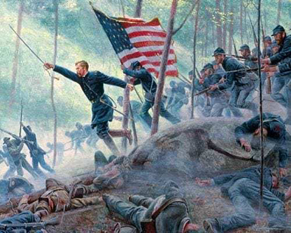
(Unless noted otherwise, historical photos, paintings, and drawings are from the Library of Congress, National Register of Historic Places, or Wikipedia. Here, the painting of Chamberlain leading the 20th Maine Regiment in their climactic charge down the hill, is by Mort Kuntsler.)
My friends Cathy and Nevin will be interested to know that, prior to the Civil War, Col. Chamberlain was a professor of rhetoric at Bowdoin College. As the morning began to clear up, the Fall Colors became more apparent.
By the time I�d driven down from Little Round Top and climbed onto the famous boulders at Devil�s Den, it looked like a proper Fall day. And yes, that is the new SL550, resplendent in its Selenite Grey Metallic paint.
I�ve been visiting Gettysburg since I was 7 years old, and my favorite activity has always been clambering around Devil�s Den. My geologist nephew Ben Webb tells me that the Devil's Den and Little Round Top boulders are hard black diabase like the Palisades of New Jersey farther north. He notes that while the Mercedes is protected by grey enamel, the iron-rich diabase takes on those brown and yellow fall colors as it oxidizes. Harder and more resistant to weathering than the surrounding sandstone, the diabase provided high ground to the Union, but the rocky soil provided no chance for entrenchment�resulting in just half of a good defensive position.
The Confederates at Devil�s Den faced withering fire from the sharpshooters and cannons on Little Round Top, as shown in this famous photograph by Alexander Gardner and Timothy O�Sullivan. While Devil�s Den is a scenic and intriguing place today, during the battle it would have been hellish. (Recent research by Scott Fink has tentatively identified the dead soldier as Private John R. Ash of the 2nd Georgia Infantry.)
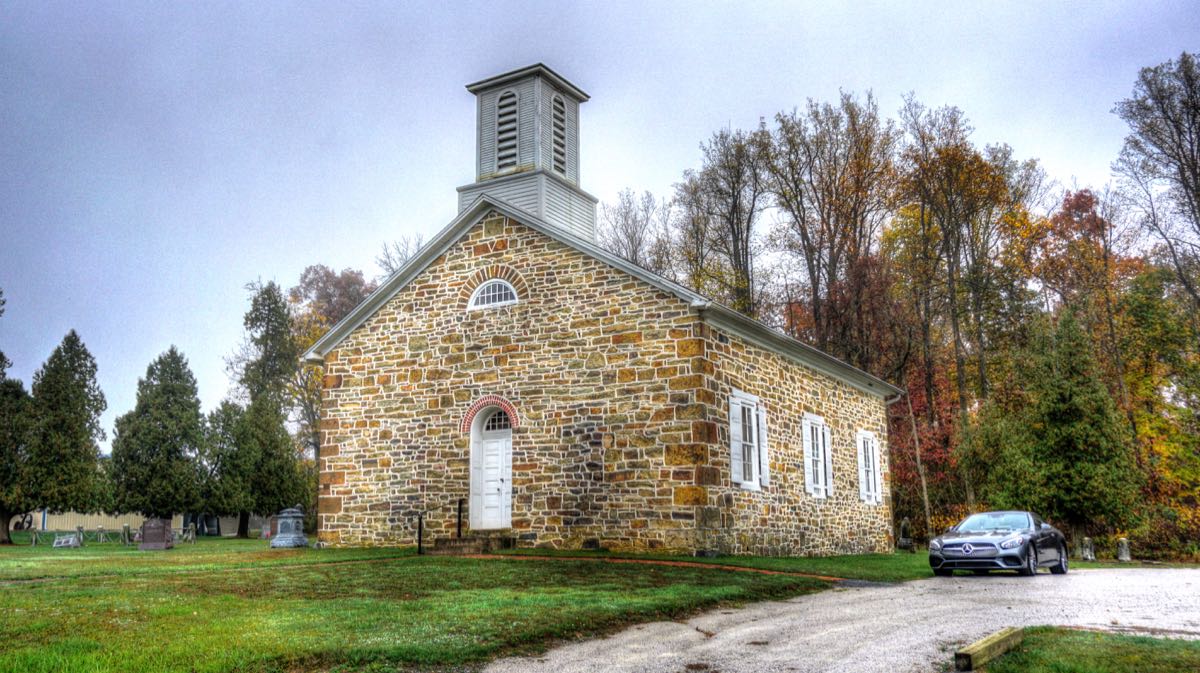
I left Gettysburg on historic Route 15, heading north for South Mountain. I was hopeful of finding some peak colors somewhere between the valley and the top of the mountain. Along the way, I stopped at the Rock Chapel Methodist Church. Construction began in 1773, and the chapel was rebuilt in its original form in 1849. Whenever Confederate troops were in the area during the Civil War, wool blankets from a nearby woolen mill were hidden in the attic of the church. Rock Chapel continued in weekly operation until 1986 but is now limited to a candlelight service each Christmas Eve.
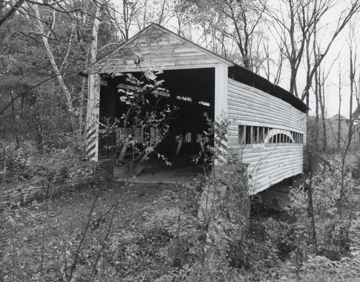
Pennsylvania is famous for its surviving covered bridges, so naturally I had to stop just a mile further on and admire Heikes Bridge. It was built in 1892 and has received a recent restoration after many years of deterioration.
The colors in the valley were modest; time to head for the hills!
Halloween was approaching, but this house wasn�t nearly scary enough to qualify as haunted. (But you never know.)
As the elevation began to rise, so did the colors. All I could find out about the old one-room schoolhouse is that it�s yours for $203,100 (including a modern 2-bedroom ranch house next to it). Schools like this one are dotted all over Pennsylvania, as I chronicled in The Mystery of the One-Room Schoolhouse.
The colors continued to bloom as I drove toward Laurel Lake, in Pine Grove Furnace State Park.
And the trees around the lake and its spillway were glorious.
My unsuspecting, pristine SL is about to be introduced to its first dirt road. (I�ve been apologizing to it ever since.)
Cold Spring Road started out paved�
�but before long it degenerated into a rough, rocky, dirt path that went on for another mile. The Mercedes was content to motor along at 10 mph while I dodged stones and washouts.
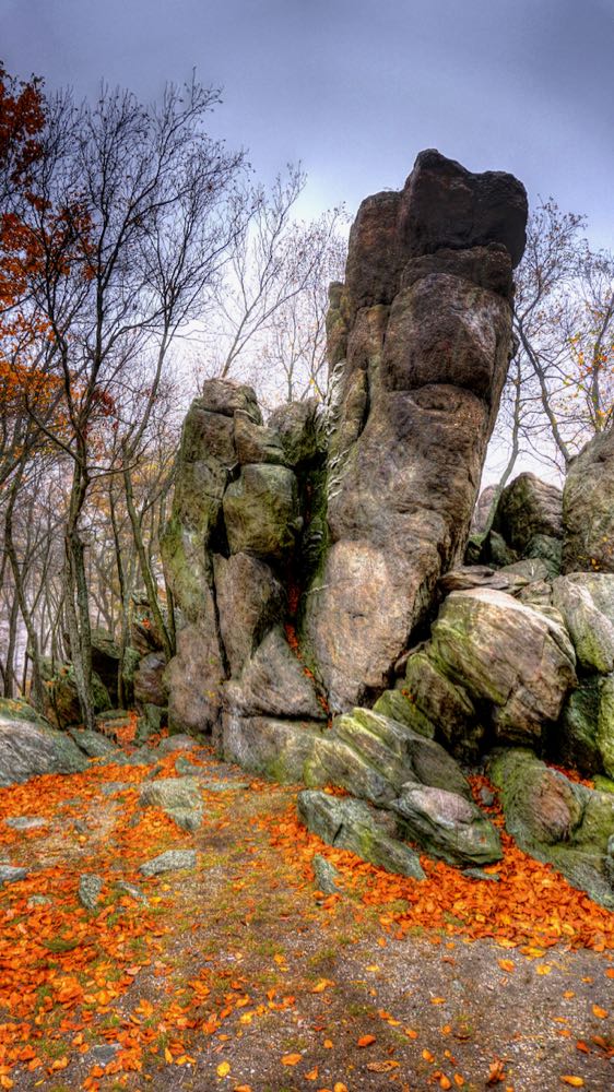
I finally made it to Hammonds Rocks, on top of South Mountain. This is another Devil�s Den-like pile of boulders, but no battles were fought here. The sandstone formation is much softer than the diabase of Devil�s Den, but it is much older�about 540 million years, give or take a few epochs. At an elevation of over 1,500 feet, almost all of the leaves had already fallen.
The rock formations are much larger than they appear in the photos. This outcropping, for example, is easily 25 feet tall. There is an ongoing fight here between graffitists and park volunteers, who erase the graffiti or paint it over with natural tones. On this day, the volunteers were winning, thankfully.
A little lower, but still on top of the mountain, the colors were more abundant.
Eventually I reached civilization, in the form of Highway 233. Descending the mountain, I did a double-take when I passed a sign for Saint Eleanor Rigby Chapel. Intrigued, I made a U-turn and retraced my steps, only to discover that my at-speed reading was a bit deficient. But it was a pretty chapel back in the woods, nonetheless. As for Saint Eleanor Regina, she appears to have been the wife of England�s King Henry III and mother of King Edward I, but it�s far from clear.
I made another climb up South Mountain to revisit some ruins near Camp Michaux. The Camp itself started life as local housing for the Civilian Conservation Corps during the Great Depression. Later, it became a secret interrogation site for captured German officers during World War II. Still later, it was a religious camp for children in the 1960s. As I reported in The Lost POW Camp, there are ruins of Camp Michaux all over the place, hidden back in the woods. But I was checking on the status of the ruins of the very old Bunker Hill Farm stone barn, built by Hessian prisoners of war after the American Revolution.
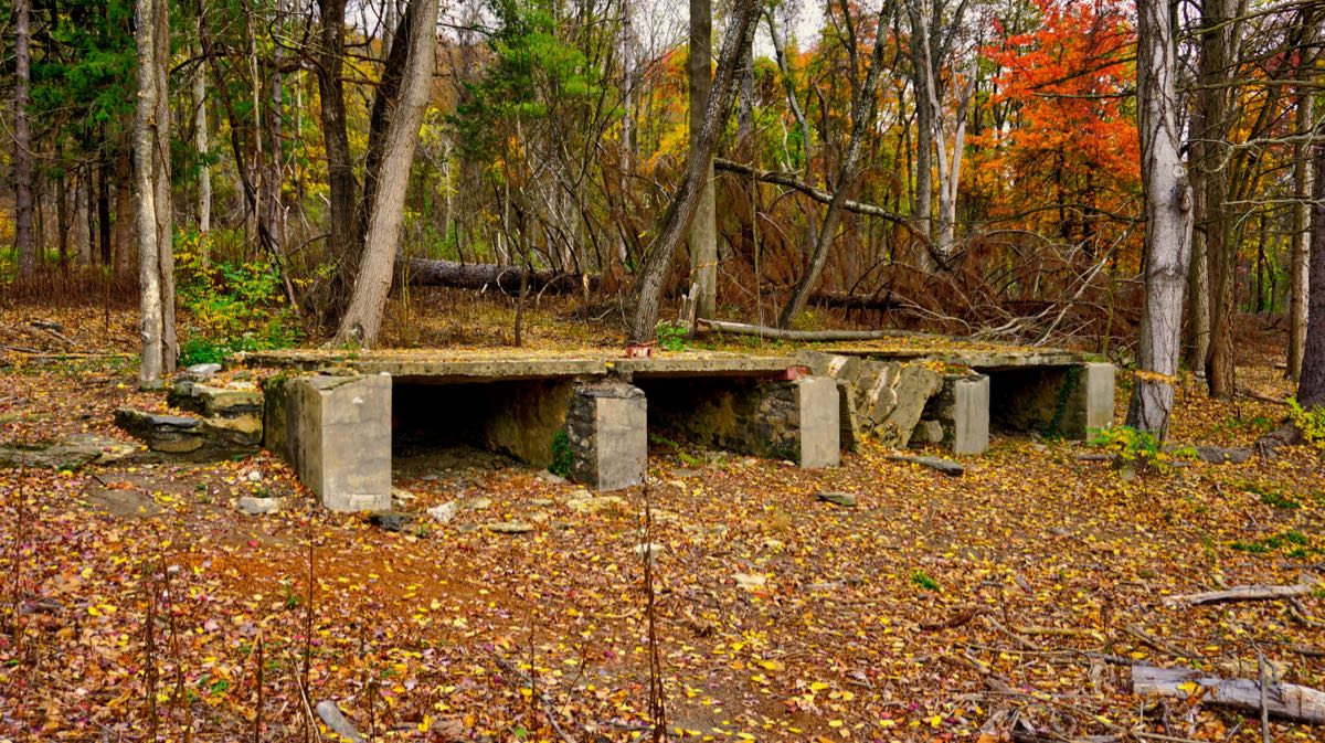
The ruins are still there, but greatly reduced in scope following a major collapse in 2016. The doorway that I walked through in 2010 is gone, as are all but one of the windows. The Appalachian Trail runs alongside, but the wall is now fenced off for safety. Compare the current photos to the one I took on my first visit here and the 1913 photo (courtesy of Lee Schaeffer�s excellent Camp Michaux website):
Nearby, I discovered the foundations of the Bunker Hill farmhouse and a concrete porch that was apparently added to the house during the POW camp years. As Calvin once told Hobbes, �There�s treasure everywhere!� (Farmhouse photo from 1913 courtesy of Lee Schaeffer, as above.)
Next up: Part II�
Last edited by Rick F.; Nov 26, 2020 at 05:50 PM.
Reason: Update title.
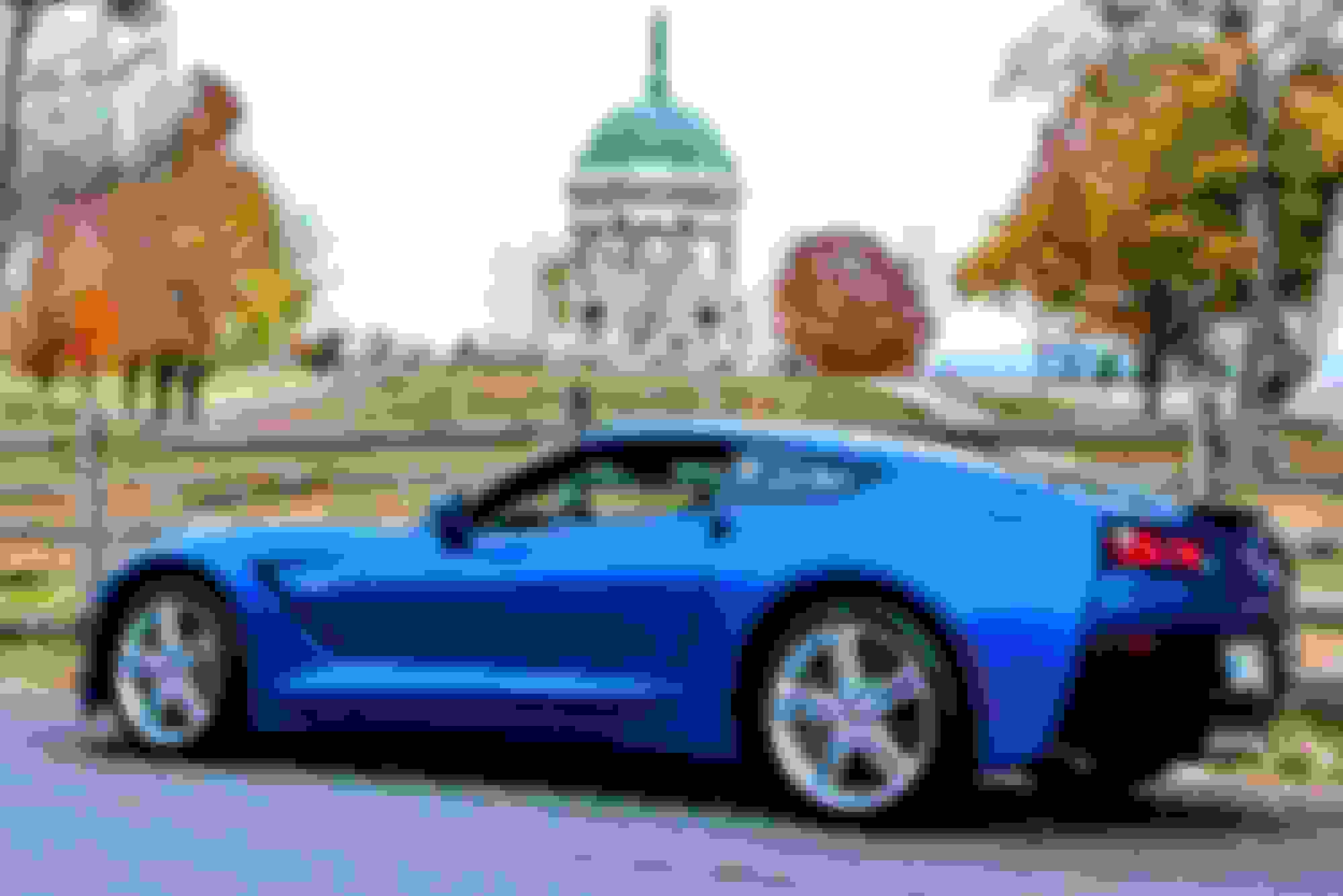
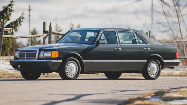
Very nice post. Living in western MD, Hagerstown, I am familiar with all of the areas you visited. This part of the US is full of history, great roads and good restaurants. If we ever end this pandemic I will be on the road. Here are a couple photos I took in Antietam National Battlefield before I traded my C7 for The SL.
Welcome to forum and thank you for a perfect first post!
Congrats also your new SL! I look forward to more posts (also of your car) and enjoy every mile...
Rick, I recall your posts on the BMW forum with a 3 series convertible if am correct, extremely good photography, and diligent research on the places you have visited; well done. While our household have moved from an SL platform to an E450 cab, I still lurk about this group, and now have another reason to browse on occasion. Enjoy your SL, I call it the addiction!
Beautiful photos -- thanks much. Grew up in Cumberland, MD, (almost south of Pittsburg) and visited Gettysburg a couple of years ago. Oh yeah -- the SL looks great too!
I'll post Part II shortly. MBWorld limits the number of photos in a post to 40, so I had to split my report up into two parts (64 photos, total). Sometimes I have well over 100 pictures, so we'll see how it works out in the future.
My first tour in the SL550 worked out really well, and I'm liking the car more and more with every mile. Now if I can just figure out how to make the "soft close" doors work�
Thanks! My wife and I finished our excellent Thanksgiving meal earlier this afternoon. Normally we're in Solomon's Island, MD this time of year, searching for fossils, but of course this isn't a normal year.
Very nice post. Living in western MD, Hagerstown, I am familiar with all of the areas you visited. This part of the US is full of history, great roads and good restaurants. If we ever end this pandemic I will be on the road. Here are a couple photos I took in Antietam National Battlefield before I traded my C7 for The SL.
Happy and Safe Thanksgiving!
Randall,
I couldn't agree with you more about the attributes of this area. I grew up in Frederick and spent many a happy day exploring the back roads, mountains, rivers, etc. on a 180cc Yamaha. You've undoubtedly driven Alternate Route 40 between Hagerstown and Frederick. From my parents' home in Braddock Heights to a slot racing store in Hagerstown was exactly 30 miles. My foolish teenage standard to meet was to make the trip in no more than 30 minutes--driving a 1951 Dodge... It's a wonder we ever survive to adulthood!
Great photos from Antietam, and I really like the C7 that you had (as well as the Benz). I co-owned a 1967 Corvette convertible with a friend, with the 327/350 engine. It was a beautiful car, but it lacked any hint of creature comforts. Even the four-wheel disc brakes were non-power.
Wonderful write up. I have never figured out why �graffiti artists� can�t stay in the cities and sometimes prefer to ruin the beauty of nature.....
UT,
Thanks! While I have to admit that some graffiti is actually quite artistic, 99.5% of it is just insolent trash. I would be in favor of a statute that requires perpetrators to remove their graffiti with only a toothbrush and Ajax.
Welcome to forum and thank you for a perfect first post!
Congrats also your new SL! I look forward to more posts (also of your car) and enjoy every mile...
Wolfman,
Thanks! MBWorld looks like the best of the Mercedes discussion forums, and I'm glad to have joined the group. Lots of good information here.
Part II of my trip report, including more SL photos, will be appended as soon as I finish replying to the comments so far. Stay tuned!
Rick, I recall your posts on the BMW forum with a 3 series convertible if am correct, extremely good photography, and diligent research on the places you have visited; well done. While our household have moved from an SL platform to an E450 cab, I still lurk about this group, and now have another reason to browse on occasion. Enjoy your SL, I call it the addiction!
TennesseeZ4,
Your memory is spot on! I started posting my car trips when I got a 2006 BMW Z4 3.0i and continued when I got the 2013 BMW 335i convertible. They were both excellent cars.
As for the new SL550, I'd have to say you're right: Addictive!
Beautiful photos -- thanks much. Grew up in Cumberland, MD, (almost south of Pittsburg) and visited Gettysburg a couple of years ago. Oh yeah -- the SL looks great too!
Gordon,
Great--I'm glad you enjoyed the report!
I've been through Cumberland many times, and there is a ton of interesting history there. I'm still hoping one day to tour the Fort Cumberland trenches from the Revolutionary War that lie beneath the Episcopal Church. And I thoroughly enjoyed the Western Maryland Scenic Railroad trip from Cumberland to Frostburg and back, a couple of years ago.
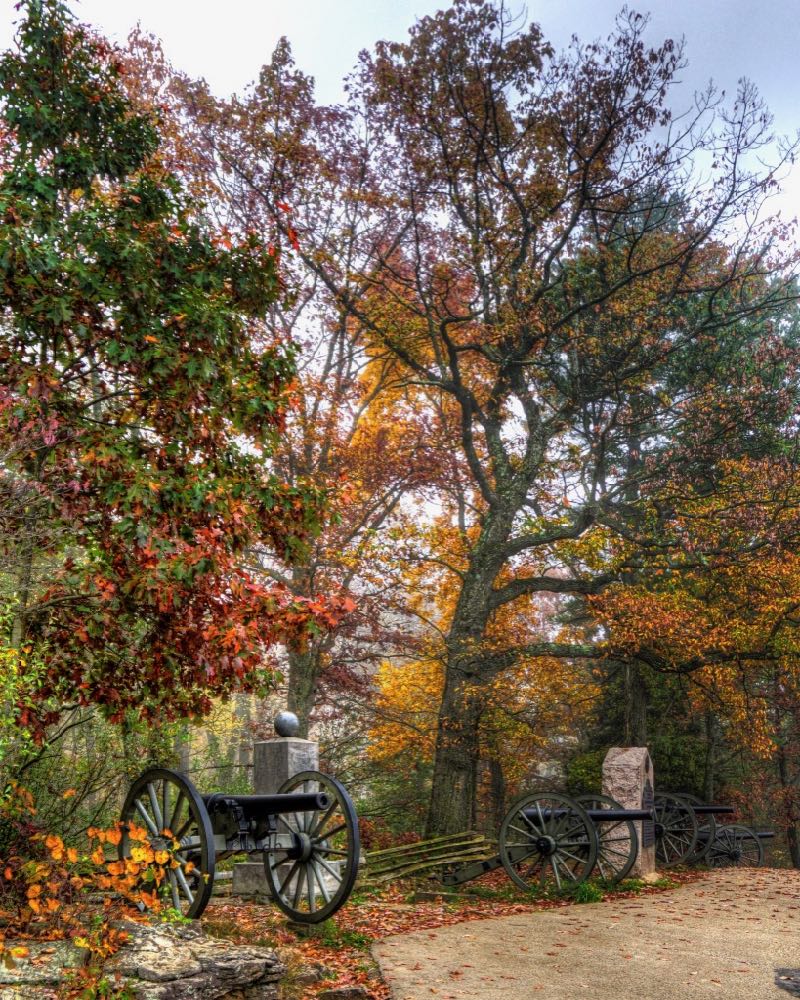
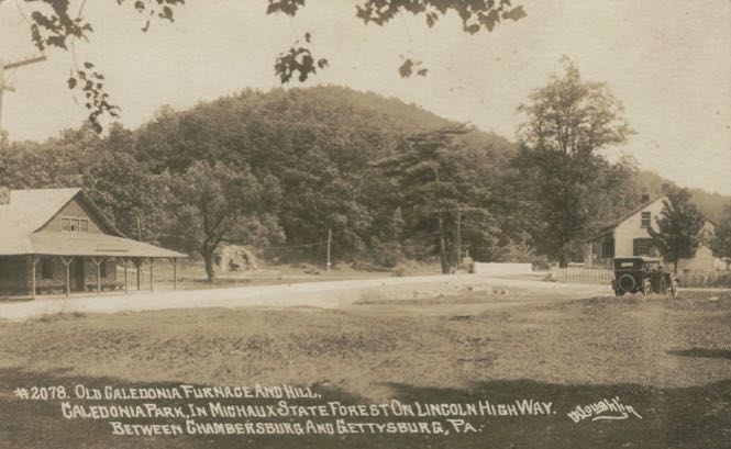
At the intersection between two mountain passes, and right by the famous Lincoln Highway, I found the Caledonia Iron Furnace. It was built in 1837 by Representative Thaddeus Stevens, a staunch abolitionist and the �father of public education� in Pennsylvania. The furnace and an associated forge were used to create ammunition for the Union Army during the Civil War. In June 1863, Rep. Stevens was overseeing the operations of the facility when General Jubal Early�s Confederate army arrived. Stevens was forcibly hidden away by his workers while the Confederates destroyed the furnace. Later, asked if he would have imprisoned Stevens if found, Gen. Early replied, �No. I would have hanged him and scattered his bones among the Confederate States.� War is Hell, they say� (Historical photos courtesy of Gettysburg Daily.)
The furnace was rebuilt after the war and operated until 1902. It is now part of Caledonia State Park. A footbridge crosses over Rocky Mountain Creek�
�and leads to a field where Rep. Stevens� blacksmith building still stands. It now houses a museum, which has been closed during the pandemic.
Continuing on, following the route I�d planned with the help of those evil twins, Garmin and Google, I encountered an unexpected fork in the road. The left option led to this barren landscape, which beckoned with promises of death and destruction. It seemed to taunt me, with the stone piles in the distance the same exact Selenite Grey Metallic as my SL550.
Needless to say, I took the right fork. The one-lane-wide paved road (ostensibly public) deposited me in the backyard of someone�s beautiful old farm. Also needless to say, I beat a hasty retreat back down what was their private driveway. Nuts!
A more circuitous route brought me to the picnic pavilion at Mont Alto State Park�the oldest state park in Pennsylvania. A merry-go-round used to operate under this canopy, and the park once attracted as many as 15,000 visitors a day. The swimming pool, shooting range, bandstand, and other features are long gone, but Mont Alto is still an attractive place for quiet family gatherings.
Did I mention that it was a beautiful Fall day, with temperatures that climbed up to the low seventies? In putting the top down, I learned that the switch is designed backwards: You pull up on it to lower the top, and push down on it to raise the top. Backwards!
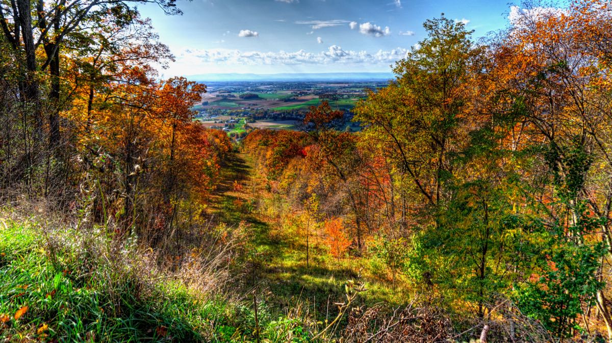
Another lengthy climb up South Mountain on a bumpy dirt road brought me to this vista. The last time I was here was 10 years ago, and while the road has deteriorated a good bit, the view is still the same�magnificent.
This passage through the trees from mountaintop to valley is a lot steeper than it looks. There�s no indication of why the passage exists. An old clearing for power lines? Or a forgotten ski lift? I have no idea. However, it nicely illustrates that the optimal Fall Colors were definitely above the valley but below the mountain peak.
Hmmm, nice-looking automobile. Definitely one that you turn around to look at as you walk away.
My planned route down the other side of the mountain turned out to be impassable, so I negotiated a longer alternative, constantly dodging rocks and potholes. Eventually I arrived at the Handycraft Farmstead, with its 1830 log home and unusual, octagonal stone smokehouse. Another unconventional feature is the springhouse: It�s built directly into the first floor of the house. The original 1790 log home is still here also, but it is now buried deep within a large expansion added in 1990.
Everywhere you looked, there were beautiful views. This property, back in Maryland, was part of Huyett�s Meadows, named for original owner Ludwick Huyett (1759-1828). In a moment of directional confusion, I neglected to get a photo of the Huyett family home, so I�ll include one from the National Register of Historic Places. �The Maples� started as a log home in the late 1700s and gained a stone addition sometime thereafter. The house retains its original double enclosed porches; most have since been converted to interior space. The property remained in the Huyett family until 1912.
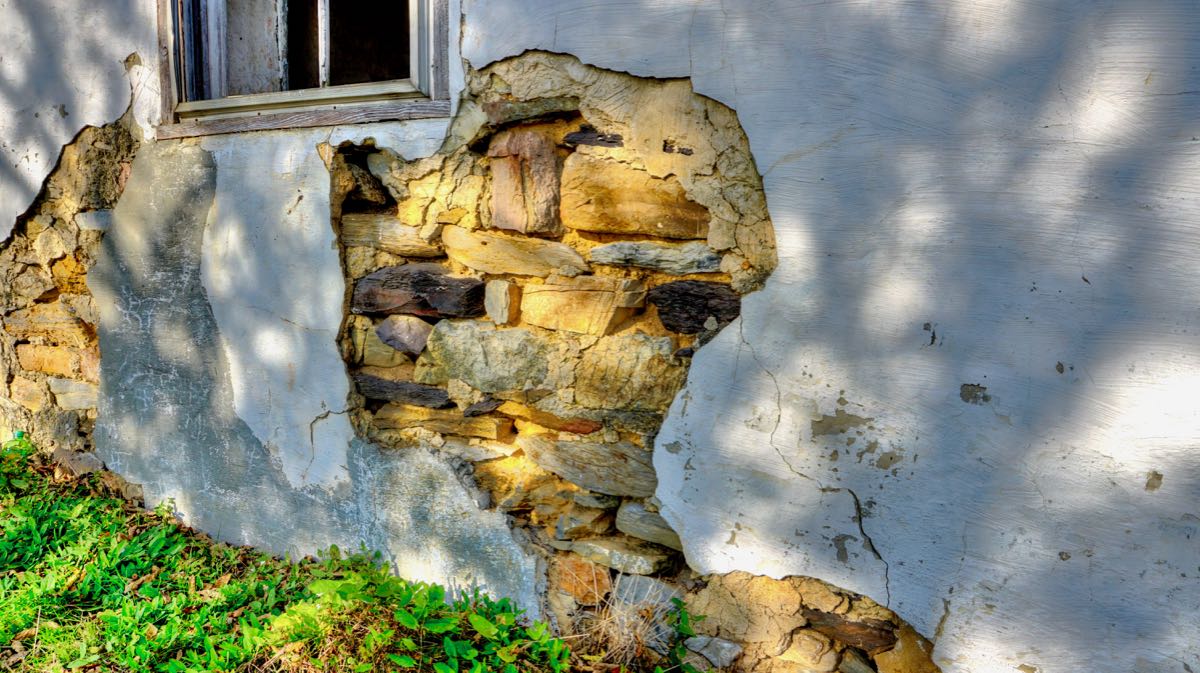
A quarter mile away, I ran across this old stone building. It looked like a house, but it didn�t appear to have an entrance anywhere.
The crumbling stucco revealed the coarse stone construction within.
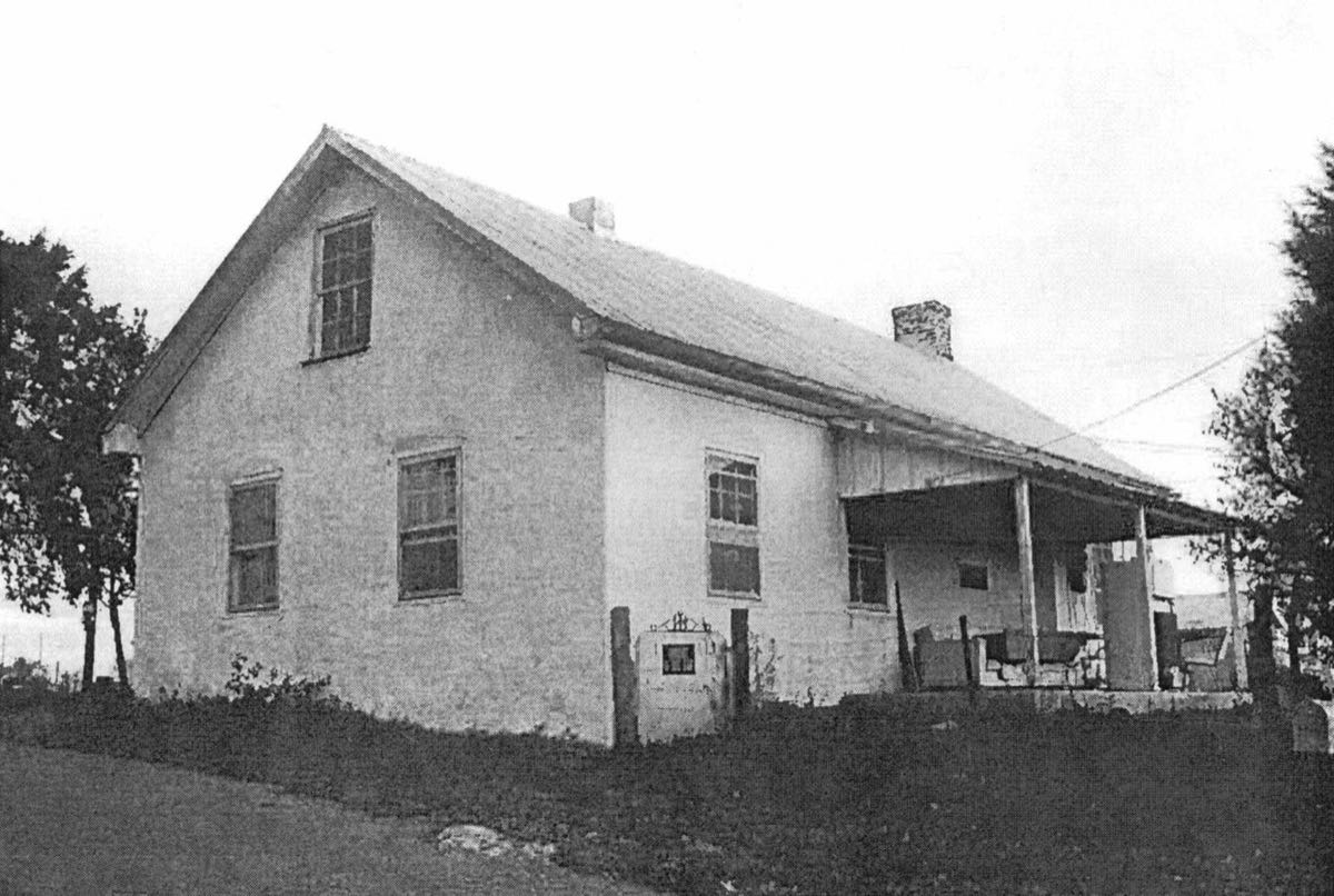
I had no idea who might have owned this odd house or lived there, but in looking for information about Huyett�s Meadows, I learned that this was the old Huyett Schoolhouse. The entrance is hidden behind vegetation, and the porch has fallen away. (Historical photo courtesy of �Mountainbiker�s� family tree on Ancestry.com. By the way� In a fruitless effort to learn more about the school, I read the entire May 26, 1849 issue of The Daily Casket.) (Really!)
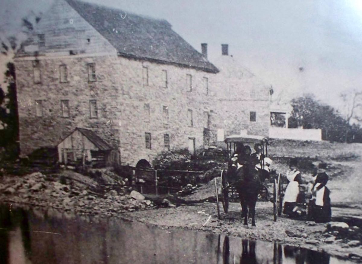
I wasn�t expecting to find Fall Colors in the hamlet of Doub�s Mill, MD, but the old mill itself is a favorite. Note how the spillway runs directly through the mill (which is now used as a residence). The structure was built in about 1782. (Historical photo courtesy of MillPictures.com.)
This colossal stone farmhouse was also built in the late 1700s. It�s somewhat ominous appearance probably qualifies it as a haunted house. The mill and surrounding homes were built by members of Samuel Newcomer�s family. The area remains remarkably unchanged roughly 230 years later.
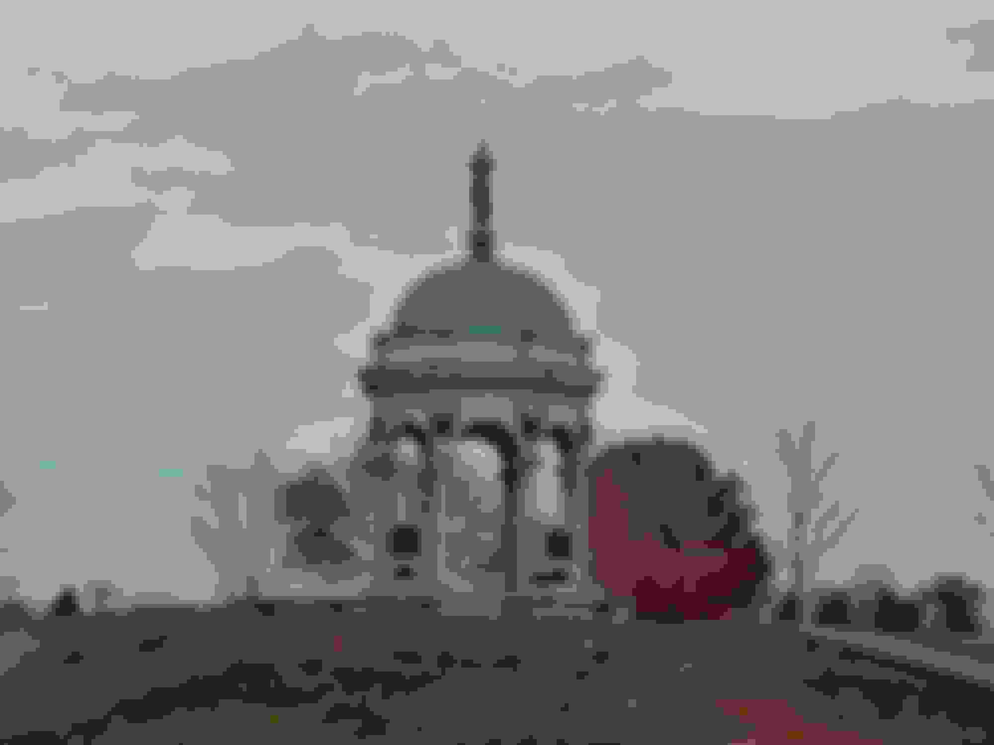
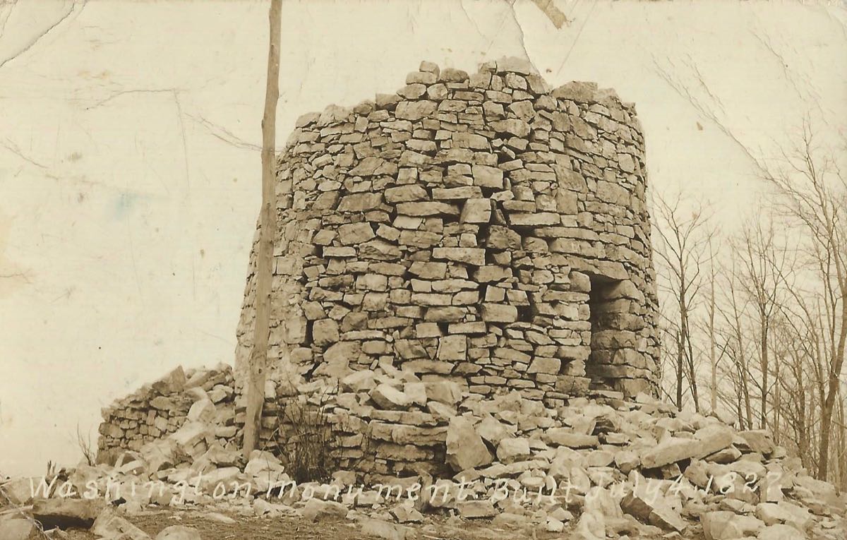
My last stop of the day was a small state park outside of Boonesboro, MD. It is home to the country�s first monument to George Washington, which you reach by hiking along the Appalachian Trail for about a quarter mile.
Do you ever have the feeling that you�re being watched? You probably are!
The view from the top of the mountain revealed the last of the day�s Fall Colors.
And I�ll finish with the original Washington Monument, which was completed in 1827, predating Baltimore�s monument by 2 years and the famous Washington, DC monument by 58 years. By the Civil War, the tower had completely fallen apart, but the Union Army still used the location as a signaling station throughout the war. The monument was rebuilt in 1882 by the Boonesboro Odd Fellows Lodge and again in 1936 by the Civilian Conservation Corps. You can climb to the top via its circular stone stairway for a great view of the valley�but not during the pandemic. (Historical photo courtesy of the https://boonsborohistoricalsociety.org]Boonesboro Historical Society.)
Throughout the day, the Mercedes ran flawlessly, whether it was ambling from one site to another or racing along the twisting back roads of Pennsylvania and Maryland. It is a fine touring sports car, and it contributed to a terrific day of searching for beautiful scenery and interesting history.
I've been through Cumberland many times, and there is a ton of interesting history there. I'm still hoping one day to tour the Fort Cumberland trenches from the Revolutionary War that lie beneath the Episcopal Church. And I thoroughly enjoyed the Western Maryland Scenic Railroad trip from Cumberland to Frostburg and back, a couple of years ago.
Rick
Yep. George Washington actually had a headquarters there and it is currently a point of interest. In jr. high and high school, (1957 -1963) on Friday nights my wife an I attended the "Satellite" dances hosted by the Episcopal Church -- many fond memories. Afterward we'd have hot dogs at Coney Island. My father was our high school principal. Cumberland and western Maryland are beautiful and that was a great place to grow up. As I recall, the tunnels under the Episcopal Church were used to allow escaped slaves to access the Potomac River. Thanks for the additional photos.
Beautiful photos and accompanying narrative. As a Canadian, I am very impressed with the interest Americans have in their history. Once in a while I will watch lectures on You Tube by various Park Rangers across America and your post reminds me of those very interesting lectures. Thank you.
Your photos and narratives were a lovely interruption to the otherwise bleak pandemic Thanksgiving holiday. I pushed your thread to the big screen and cycled then for a bit just to see them in full splendor. Well done!!
This is exactly why I bought the SL and your post has inspired me!
Yep. George Washington actually had a headquarters there and it is currently a point of interest. In jr. high and high school, (1957 -1963) on Friday nights my wife an I attended the "Satellite" dances hosted by the Episcopal Church -- many fond memories. Afterward we'd have hot dogs at Coney Island. My father was our high school principal. Cumberland and western Maryland are beautiful and that was a great place to grow up. As I recall, the tunnels under the Episcopal Church were used to allow escaped slaves to access the Potomac River. Thanks for the additional photos.
Gordon,
I've actually been working on a trip report based on the rivalry between McNeill's Rangers and General Benjamin Kelley during the Civil War. It's quite a story, and it culminated in Jesse McNeill's daring raid into the heart of the Union forces stationed at Cumberland to kidnap Generals Kelley and George Crook. I got bogged down in the project because the report was over 8,000 words, and I decided to separate it out into a Civil War section and a Revolutionary War section. I'll get back to it (them) soon, but lately it's been way more fun to get acquainted with the new SL550.
Cumberland is a fascinating area, and I especially like the mansions on Washington Street. Very impressive!
Thank you letting me live my dream vicariously through your posts.
MBNUT1,
My pleasure--I'm glad you enjoyed them!
I truly appreciate every chance to get out and do some exploring in an interesting car. I can't drive by a road named anything like "Old School Road" or "Old Mill Road" without turning onto it to find out if the old whatever still exists. And Wikipedia is a godsend for identifying lost and forgotten places worth tracking down.
Other good sources of information on interesting places are RoadRunner Magazine, Mad Maps, the various "Scenic Byway" brochures produced by almost every state, and even the "Weird Maryland" and other Weird State books.
I'm glad to have provided vicarious fun, and I hope that you'll get a chance to do some exploring of your own sometime soon!
Mercedes SLR McLaren 722 S Is Extremely Rare Example Modified by McLaren
Slideshow: A one-of-one U.S.-spec Mercedes-Benz SLR McLaren Roadster became even rarer after a factory-backed transformation at McLaren's headquarters.